Geology for a sustainable management of our Planet
Bari, 3-5 settembre 2024
Field Trips
Pre Congress field trips
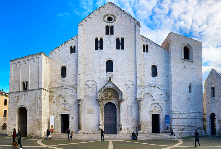
FT1. Exploring the cultural heritage of Bari
Field leader(s): Giacomo Eramo1, Alessandro Monno1, Monica Mastrorilli1
1 Department of Earth and Geoenvironmental Sciences, University of Bari Aldo Moro
Itinerary: Teatro Petruzzelli, Molo San Nicola, Piazza Massari, Fortino di S. Antonio Abate, Basilica di San Nicola, Cattedrale di S. Sabino, Castello Normanno Svevo, Arco Basso and Arco Alto.
Date: 2 September 2024; duration: 9:00 - 13:00
Minimum number of participants: 20
Maximum number of participants: 60
Costs (all included): € 17
This guided tour offers an immersive experience into the rich tapestry of Bari's cultural heritage, blending ancient traditions with iconic monuments. Beginning at the Teatro Petruzzelli, our journey continues along the picturesque seafront promenade (Lungomare), where the timeless ritual of fishermen hauling in their daily catch and shows Bari's enduring maritime identity. As we navigate the labyrinthine streets of Bari's old town, we trace its evolution from ancient Roman settlements to medieval citadels and Baroque masterpieces, immersed in the scent of freshly baked focaccia and the lively banter of locals evoke the city's authentic spirit. Highlights include the majestic Basilica di San Nicola, Cattedrale di S. Sabino, Castello Normanno Svevo and the works of art contained therein. At the end of the walk, participants will be free to delve into the city's culinary delights with a taste of traditional Apulian cuisine at authentic trattorias, savoring specialties such as orecchiette pasta, focaccia and freshly caught seafood.
Cost includes tour guide, entrance to the cathedral basement and insurance policy. Lunch is not included in tour participation fees.
Optionally, an additional street food selection (focaccia, panzerotto, octopus sandwich/vegetarian variant, and artisanal ice cream) can be chosen for an additional charge of €25.00 per person which must be paid on site.
Further indications: the walk will take place on foot in flat urban area, except for some short stairs to reach the cathedral's underground or the old town walls. Rather high temperatures (25-30° C) and a wet climate are expected. It is advisable to bring sunscreen, hats with visors, sunglasses and a light raincoat in case of light rain. Comfortable shoes are also recommended.
Post Congress field trip
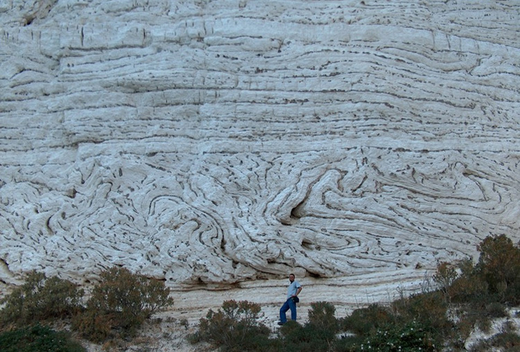
FT2. Geology, georesources and geoheritage of the Apulia Carbonate Platform: a novel from the Gargano to the Murge
Field leader(s): Luigi Spalluto1, Giacomo Eramo1, Italo Muntoni2, Fabio Massimo Petti3
1 Università degli Studi di Bari Aldo Moro.
2 Soprintendenza Archeologia, Belle Arti e Paesaggio per le provincie di Barletta-Andria-Trani e Foggia, Ministero della Cultura.
3 MUSE - Museo delle Scienze di Trento.
Itinerary:
Day 1: Bari (departure from Campus at 7:30), Peschici (lower Cretaceous cherty limestones and old chert mines – Valle Guariglia archaeological site), Vieste (cherty limestones and old chert mines – Defensola archaeological site), Vignanotica beach (Maiolica limestones and slumpings); Monte Sant'Angelo (hotel arrival at 7:30 pm)
Day 2: Monte Sant'Angelo (upper Cretaceous slope successions), Borgo Celano (Hauterivian peritidal limestones and dinosaur footprints), Bauxite Mines (intraCretaceous unconformity marked by bauxites), Pantano di Sant'Egidio (Mattinata Fault), Monte Sant'Angelo (hotel arrival at 7:00 pm)
Day 3: Monte Sant'Angelo (departure at 8:00), Canosa (Christian catacombs of Lamapopoli), Molfetta (Albian peritidal limestones and dinosaur footprints), Pulo di Molfetta (sinkhole), Bari (Airport and Railway station arrival around 4:30 pm)
Date: 6-8 September 2024
Minimum number of participants: 10
Maximum number of participants: 15
Costs: € 386 (single room) € 350 (double room)
This excursion will explore the geology, georesources and geoheritage of several sites where Mesozoic limestones and cherts of the Apulian carbonate platform crop out. The topics covered will be: i) regional geology of the Puglia region; ii) carbonate sedimentology of Cretaceous platform-to-basin successions; iii) georesources extracted from Cretaceous successions (cherts, building stones, bauxites); iv) Early Christian catacombs; v) geosites preserving dinosaur footprints; vi) sinkhole.
Further indications: The field trip difficulty is low, apart from a couple of quarries having an uneven bottom surface. Rather high temperatures (25-30° C) and a dry climate are expected. It is advisable to bring sunscreen, hats with visors, sunglasses, and a light raincoat in case of light rain. Hiking or trekking shoes and long trousers are also recommended. The cost includes: insurance policy; half board accommodation in hotel; lunch on the first day; packed lunch on the second and third day; bus transport. The cost does not include the tourist tax of € 1.5 per day (to be paid in cash at hotel check-out).
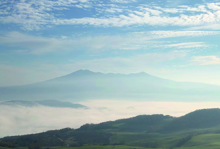
FT3. Vulture: Exploring the Volcanic Geology, Igniting Tourism, and Savoring the Wines of a Unique Region
Field leader(s): Paolo Giannandrea1, Daniela Mele2, Fabio Dioguardi2, Francesco Neglia2
1 Università della Basilicata.
2 Università degli Studi di Bari Aldo Moro.
Itinerary: Mount Vulture
Date: 6 September 2024.
Minimum number of participants: 10
Maximum number of participants: 25
Costs (all included): € 95
Vulture volcano is a composite volcano located at the easternmost border of the Apennine Chain in Southern Italy. The volcanic rocks cover an area of approximately 150 km2 in the Mount Vulture and are the result of both explosive and effusive activity that took place from the middle Pleistocene. Compared with other major Quaternary volcanoes of Italy that are scattered along the Tyrrhenian margin, Mount Vulture is the only volcano located to the east of the Apennine chain on an along-dip vertical slab window. Volcanic activity at Mt Vulture started at 698 ± 8 ka and continued until 141 ± 11 ka, although this interval was characterized by a number of quiescent periods, in which the sedimentation of alluvial and lacustrine deposits in the Venosa Basin have been realized.
The Mount Vulture is one of the more important aquifers in southern Italy and the main Italian reservoir of effervescent-mineral waters that are pumped for drinking and irrigation purposes. It is characterized by the presence of numerous CO2-rich mineral springs and wells, and the two volcanic maars-called "Monticchio Lakes". The Lago Piccolo and Lago Grande were created by intense explosive volcanic activity when a relatively small volume of erupted magma sprayed out over a large area.
This fieldwork is aimed at providing a general overview of the Mount Vulture eruptive history, its relationship in the geological context of the area and the volcanic activity styles, with an analysis of the products of both effusive and explosive phases. The fieldwork will conclude with a visit to the "Cantine del Notaio" winery, which produces the famous Aglianico wines that are refined in volcanic tuff caves.
Itinerary: Departure from Campus Universitario Via E. Orabona 4, Bari 7:30 am;
Stop 1 - on the road to Melfi. First panoramic and introductive stop;
Stop 2 - Melfi "Hauynofiro";
Stop 3 - Gaudianello outcrops;
Stop 4 - Panoramic view of the Monticchio Lake, St Michael's Abbey; Stop 5- Sant'Antonio quarry outcrop (Rionero in Vulture); Stop 6 – Visit to the "Cantine del Notaio" winery and Aglianico wine tasting.
Further indications: Clothes and shoes suitable for hiking are mandatory. Early September can still be very hot and sunny, therefore caps, sunglasses and sunscreen are strongly recommended. Costs cover lunchbox, bus transfer, tour of the winery and wine tasting. The cost incudes insurance policy.
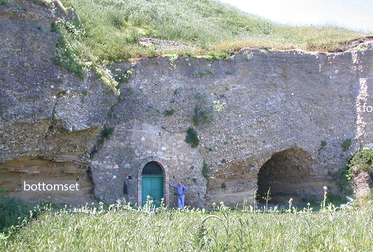
FT4. The Bradanic Trough: stratigraphic response to subsidence, shortening and uplift of the Quaternary south-Apennines foreland-basin
Field leader(s): Marcello Tropeano1, Luisa Sabato1, Domenico Chiarella2, Salvatore Gallicchio1, Sergio G. Longhitano3
1 Università degli Studi di Bari Aldo Moro.
2 Royal Holloway, University of London.
3 Università della Basilicata.
Itinerary:
The first day (6 September 2024), moving from Bari to Minervino, we will cross from E to W the Apulian Foreland looking out the Bradanic Trough (the Quaternary south Apennines foreland-basin). We will observe the response of temperate carbonate systems unable to match with the subsidence in the outer margin of the foreland basin. Then, we will move to Genzano di Lucania to observe coarse-grained siliciclastic coastal deposits representing the oldest undeformed deposits of the top of the Bradanic Trough (end of shortening [?], and response of coastal systems to the first stage of definitive filling of the foreland basin). The last stop is in Acerenza, where we will discuss about sedimentology and stratigraphy of Quaternary tide-influenced shallow-marine systems developed on moving thrusts (wedge-top area). In the late afternoon we will transfer to Potenza.
The second day (7 September 2024), we will observe in the surrounding of Potenza some coarse-grained deltas and their stacking patterns reflecting various morpho-tectonic conditions proper of a satellite basin of the wider wedge-top system. Then, we will first visit Tricarico, to observe mixed deposits representing tide-influenced systems coeval to in Acerenza, second Calciano, to see the big fan delta developed at the front of the chain when the Genzano succession aggraded in the north of the foreland basin and, finally, Grassano, where the village was built "inside" and on a very small Gilbert type delta ("I Cinti" locality). A panoramic view from the chain front to the Ionian Sea will lead us to discuss about the middle-late Quaternary uplift-related staircase of terraced marine deposits developed in the hinterland of the Taranto Gulf. In the afternoon we will return to Bari.
Date: 6-7 September 2024
Minimum number of participants: 15
Maximum number of participants: 30
Costs: € 250,00 (single room); € 200,00 (double room)
The Susa Valley, carved by a prolonged glacier erosion in the core of the Italian western Alps, has been used since classical era as a major communication route between Po Plain region and France, up to Europe at large: it represents a natural way through the Alpine passes. It exposes a section of metamorphic geologic units of continental and oceanic pertinence: several amazing types of ornamental and building stones were, and still are, exploited for heritage purposes and for local infrastructures.
Running the Susa Valley from its lower to upper part, the field trip aims to illustrate the geological-geomorphological features of this valley and to discuss the main steps of the geological studies during the 19th -early 20th centuries in this alpine sector, fundamentals for the geological interpretation of the entire western Alps.
During the field trip, the variety of ornamental stones (meta-ophicarbonate, prasinite, marble, gneiss and quartzite among the others) of the Susa Valley will be shown thanks to outcrops and abandoned quarries and visiting famous historical buildings, such as the Sacra di San Michele (a medieval abbey considered the symbol of Piemonte Region) located on the top of Monte Pirchiriano, and as the Arch of Augusto (built at the end of the 1st century BC) in Susa village.
Due the importance that Susa Valley has always had in the socio-economic and cultural relations between Italy and Europe, the trip is also dedicated to discuss the history of main projects for tunnels and railways in this valley.
Further indications: No track difficulties, sunscreen is needed. The cost includes insurance policy, accommodations in hotels with dinner and packed lunch and bus transfer.
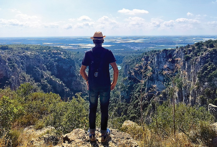
FT5. New tools to discover the territory: the Gravina di Laterza through two geotouristic itineraries
Field leader(s): Filippo Bellini1, Rosa Colacicco1
1 Università degli Studi di Bari Aldo Moro.
Itinerary: Gravina di Laterza.
Date: 6 September 2024
Minimum number of participants: 15
Maximum number of participants: 20
Costs (all included): € 60
The excursion starts at 7:30 a.m. with bus from Bari in the direction of Laterza. In the morning at 9:15 a.m. the geotouristic itinerary of the Gravina di Laterza will be followed, starting from the Oasi LIPU. The first part of the route consists of the exploration of the viewpoint and the "Grotta Croce" site. Afterwards we will continue towards the completion of the itinerary along the edge of the canyon with some stops and viewpoints along the same route. Distance to be covered 3.5 km, with an estimated duration (round trip) of 4h. At 1:30 p.m. there will be lunch at the accommodation facility in Laterza. At 3:30 a.m. we resume with the city's geotouristic itinerary starting from the Mater Domini Sanctuary, up to the Palazzo Marchesale with a visit to the ceramic's museum of Laterza MUMA.
During the itinerary it will be possible to appreciate how the imposing river incision deepened within the Cretaceous limestones is established in a sub-flat territory. From a geotouristic point of view, is very characteristic the link between the geological features and the development of the rupestrian settlement of Laterza and how man has exploited the resources present in the area is important.
Further indications: Difficulty: easy, recommended hiking clothing with boots, long trousers and hat. 2 liters of water and sunscreen are recommended. The cost includes insurance policy, transport from Bari to Laterza, lunch at a farmhouse, guided tour of the MUMA Ceramics Museum.
FT6. The Standard Auxiliary Boundary Stratotype (SABS) at Montalbano Jonico (Matera) in the southern Apennines foredeep: a geological tour into Middle Pleistocene chronostratigraphy and climate
Field leader(s): Maria Marino1, Salvatore Gallicchio1, Angela Girone1, Rafael la Perna1, Patrizia Maiorano1
1 Università degli Studi di Bari Aldo Moro.
Itinerary: Montalbano Jonico (Matera)
Date: 6 September 2024
Minimum number of participants: 12
Maximum number of participants: 18
Costs: € 80,00
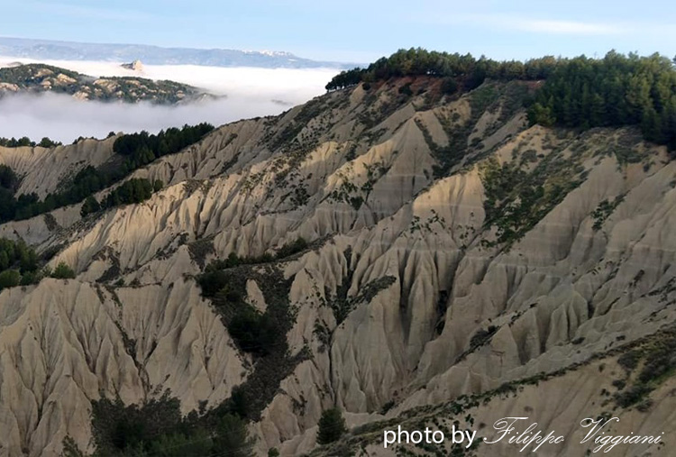
The field trip starts from Campus Universitario Via E. Orabona 4, Bari at 7:30 am and is mostly dedicated to the spectacular badlands of Montalbano Jonico (MJ), with a special focus on the Ideale Section (IS) as a portion of the 500m-thick MJ marine succession belonging to the argille subappenine unit. Our itinerary takes place in the "Special Natural Reserve of the Montalbano Jonico badlands", at the southwestern margin of the Bradanic Trough, about 16 km inland from the Ionian Coast. The IS is one of the best exposures of marine sedimentary records encompassing the Lower-Middle Pleistocene boundary at 774 ka, a key interval of Earth's climate history. On July 2023 the IS was approved as a Standard Auxiliary Boundary Stratotype (SABS) for the Global Boundary Stratotype Section and Point (GSSP) of the Middle Pleistocene Subseries/Subepoch. Climbing the IS, the field trip aims to illustrate the continuous sedimentary marine record spanning the Marine Isotope Stage (MIS) 20–18 interval, including the radiometrically dated volcaniclastic layers and the rich, highly diversified, and well-preserved documentation of Pleistocene macro-invertebrates from circalittoral-upper bathyal setting. The trip will be also an opportunity to discuss on the climate signatures recorded in the section, based on marine and terrestrial paleontological signals and geochemical proxies. After lunch on a ledge of Montalbano town with a wonderful badland panoramic view, the trip continues with the visit to Tempa Petrolla, an extraordinary geological site, where a Tertiary calcareous flysch spire rises from the surrounding clays, representing one of the youngest outcropping tectonic structures of the Apennines front.
Further indications: A minimal trekking attitude and standard field work equipment is required. September in Basilicata is usually warm and dry, consequently, sunglasses, sun-tan lotion and water are strongly recommended. Cost includes insurance policy, bus transfer and lunch.
FT7. Rocks and soils in the Salento area: from resource to hazard
Field leader(s): Piernicola Lollino1, Francesca Micheletti1, Stefano Margiotta2
1 Università degli Studi di Bari Aldo Moro.
2 Università del Salento.
Itinerary: Salento area.
Date: 6-7 September 2024
Minimum number of participants: 15
Maximum number of participants: 25
Costs (all included): € 230
The field trip represents an attractive opportunity for knowledge and enjoy some Puglia wonders.
The first stop will be dedicated to visit some emblematic examples of the Lecce baroque style (Basilica di Santa Croce, Palazzo dei Celestini, the Duomo and the adjacent square) built with the soft and degradable calcarenite. The stops in the afternoon will instead allow us to observe the instability processes affecting the soft calcarenite cliffs along the Torre dell'Orso coastline, with evidence of rockfall processes recently occurred and on-going. The evening of 6 September will be passed in the beautiful town of Otranto, where it will be possible to walk in the Middle-Age touristic historical center.
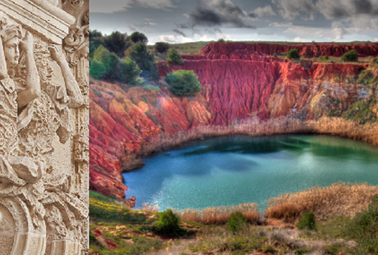
The last stop (morning of 7 September) will allow to appreciate the geological and naturalistic features of one of the most popular geosites in Puglia: the abandoned open-pit mine in bauxite "Lago delle Orte" (Otranto).
Day 1 (6 September): 07:00 - Departure from Bari to visit the historical centre of Lecce in the morning; in the afternoon Costa di Melendugno - Torre dell'Orso; dinner and overnight in Otranto.
Day 2 (7 September): in the morning abandoned open-pit mine in bauxite "Lago delle Orte" (Otranto); lunch time, departure to Bari (estimated arrival at 15:30).
Further indications: All stops are easily accessible and require minimal trekking attitude and standard field work equipment (i.e., comfortable clothes, trekking shoes, a hat for the sun, a protective sun cream, a light backpack). Warm and dry temperatures expected; do not forget your swimsuit! Costs cover insurance policy, accommodations in hotels with dinner and bus transfer. The two packed lunches are not included.
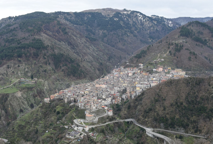
FT8. Across the nonconfomity: from the late Variscan crystalline basement to the Neotethyan stratigraphic succession around Longobucco (Calabria, southern Italy)
Field leader(s): Vincenzo Festa1, Salvatore Gallicchio1, Francesca Micheletti1, Francesco Muto2, Enrico Tavarnelli3
1 Università degli Studi di Bari Aldo Moro.
2 Università della Calabria.
3 Università di Siena.
Itinerary: Variscan crystalline basement to the Neotethyan (Calabria, southern Italy)
Date: 5-7 September 2024
Minimum number of participants: 15
Maximum number of participants: 20
Costs: € 325,00 (single room); € 295,00 (double room)
Day 1 (5 September): Late afternoon, departure from Bari to Camigliatello Silano (CS), in the Sila National Park. 1st overnight in Camigliatello Silano
Day 2: An itinerary across the basement cropping out in the Sila National Park. K-feldspar mega-crystals granodiorites of the late Variscan Sila batholith, near Longobucco (CS) village; late Variscan injection zone and contact metamorphism in Palaeozoic phyllites, through the Monte Sordillo area; pre-intrusive ductile shearing in the host-rock of the Sila batholith. 2nd overnight in Camigliatello Silano
Day 3: The nonconformity between the phyllites and the deepening upward stratigraphic succession along the Trionto River valley: (a) The Hettangian – Rhaetian? basal continental red beds; (b) the carbonates of the Sinemurian platform; (c) the Carixian – Lower Domerian shelf and slope marls; (d) the Upper Domerian – Lower Toarcian turbidites. Structural features will be observed along the décollement of a Tertiary thrust, that, propagating across the basement-sedimentary cover nonconformity, carries the Palaeozoic phyllites onto the Mesozoic stratigraphic succession. Late afternoon, departure to Bari (estimated arrival, before dinner, at 7:30 pm).
Further indications: Itineraries on well-marked secondary roads or mule tracks, and on paths that may be locally not clearly visible; there are also steep sections and easy rock passages, which, however, do not require specific mountaineering knowledge; the total planned route is of about 6 km, at elevation around 1000-1200 m and 400-600 m above sea level, during Day 1 and Day 2, respectively. Trekking shoes and hiking clothing adequate for maximum temperatures around 30 °C, sudden rainfall and fresh evenings are recommended; carry sunscreens and medication against insect bites; vipers and scorpions may be encountered. The cost covers insurance policy, accommodations in hotels with dinner and packed lunch and bus transfer.